

Day 4 of our visit to this Area of Outstanding Natural Beauty. Day 1 is here, day 2, here, and day 3, here.
Our walk along the Rhossili Beacon had been pretty challenging, so we thought we’d stick to more level ground for the day following our wedding anniversary. The Ordnance Survey Explorer map of the Gower (164) showed a number of paths along the coast, and we’d picked up the National Trust’s useful leaflet about Rhossili, which also detailed a number of local paths, so we decided we’d take a circular route via Mewslade Bay.

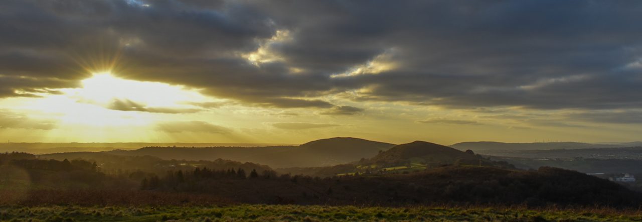
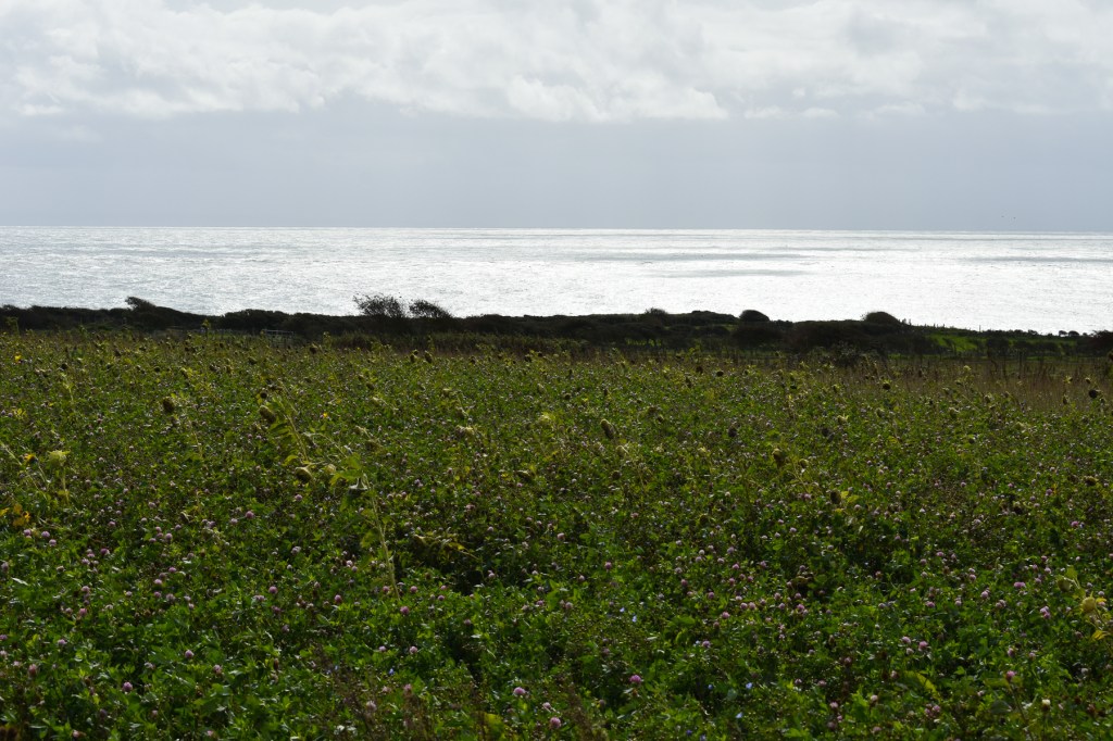
We set off along the track toward Worm’s Head, as that leads to other coastal paths including the Wales Coast Path, which we intended to follow. The wind was still strong, but less than the gale force of the previous day, and the sky appeared to have watched the weather forecast and agreed with the BBC that rain was less likely. In fact, for most of the way we travelled under broken cloud with patches of welcome blue. Just a short spell of rain toward the end of our walk, followed by a lot more once we were back in the hotel.

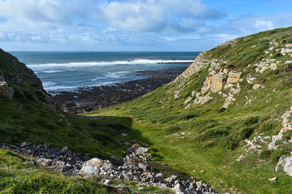
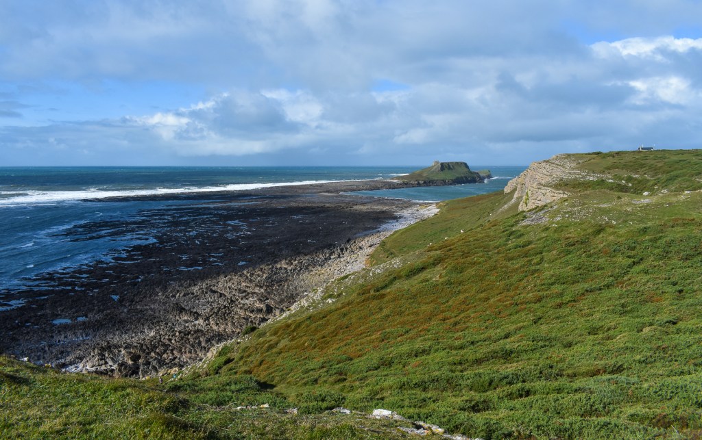
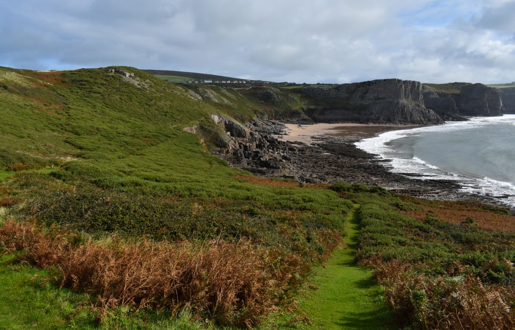
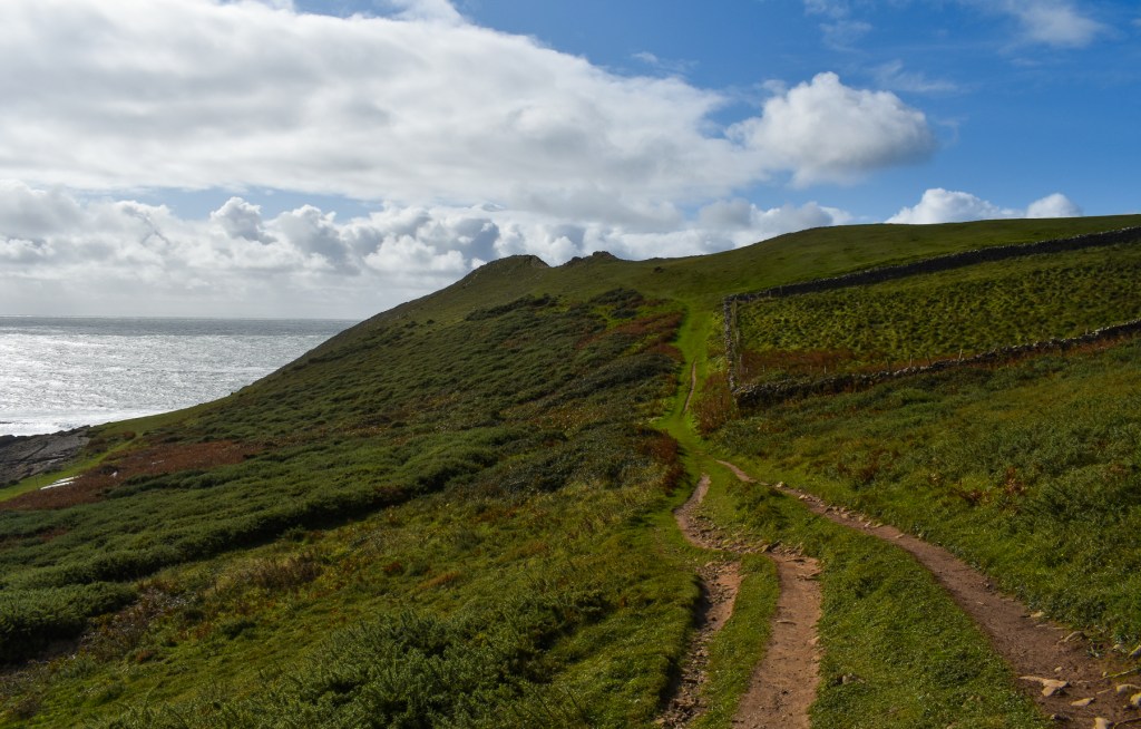
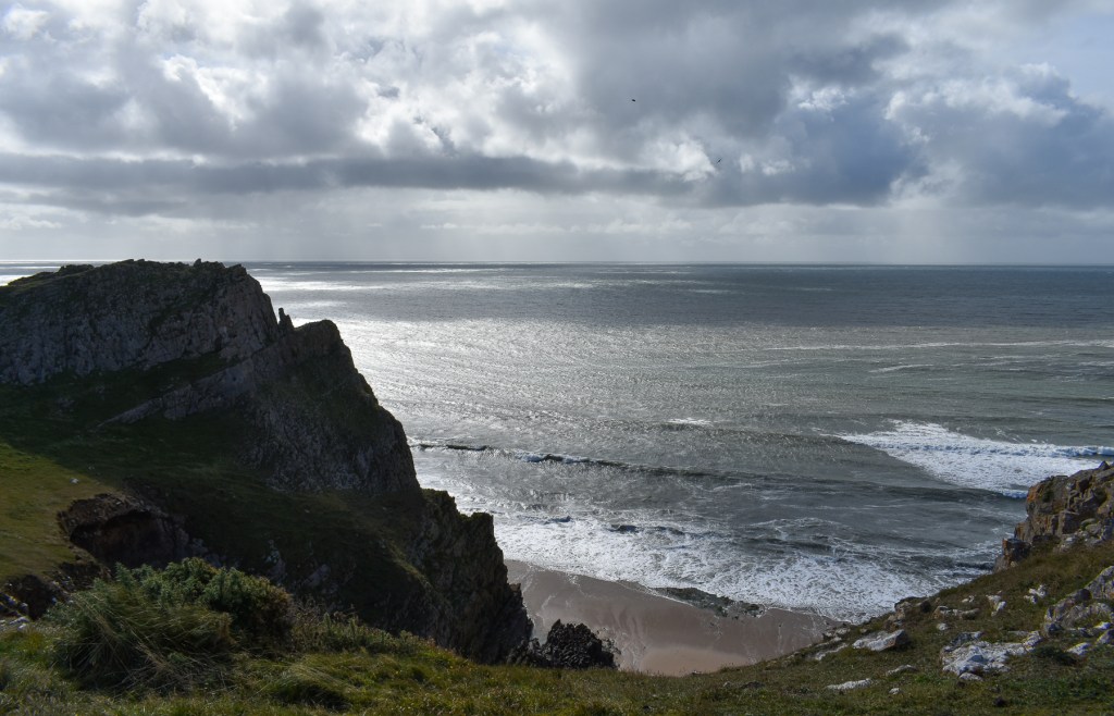
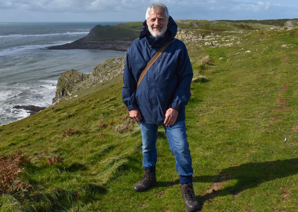
We met few people as we’d set off relatively early, after a good breakfast. Rhossili Bay appeared on our right for a while until we reached the point not far from the Coast Guard Lookout Station, where we turned south to follow the drystone wall along the top of the cliff, slowly turning southeast toward Tears Point. From the path, we had good views of the craggy cliffs that characterise this coast and, behind us, of the Worm’s Head. The village slowly came into view over the top of the wall to the northeast.


It was a quiet trek and we enjoyed the fresh breeze and changing views as the dips and rises gave us new perspectives.
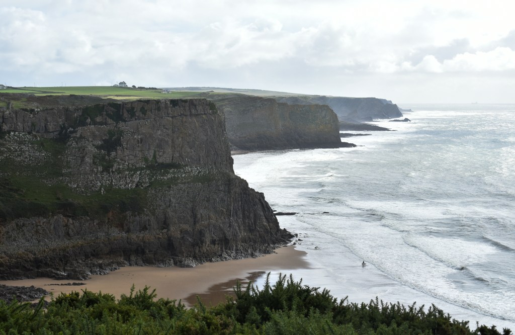
At Tears Point we turned northeast for a short way, now moving toward Fall Bay, a popular spot for surfers. We were tempted off the main path here, hoping to descend to the attractive looking beach below, where we could see a surfer entering the breakers. But the way down was narrow, steep and very slippery, so we allowed discretion to be the better part of valour and continued along our way.


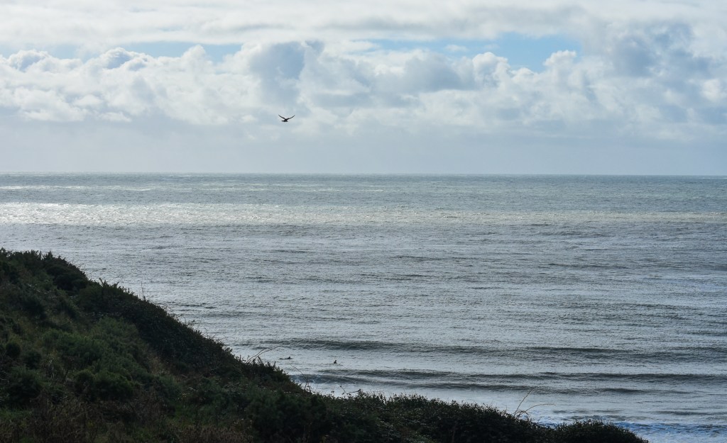
At one point, we spotted a Merlin hovering briefly over the water, and I managed to capture it on my camera; a small image, but one that encapsulated the environment and the bird in flight.

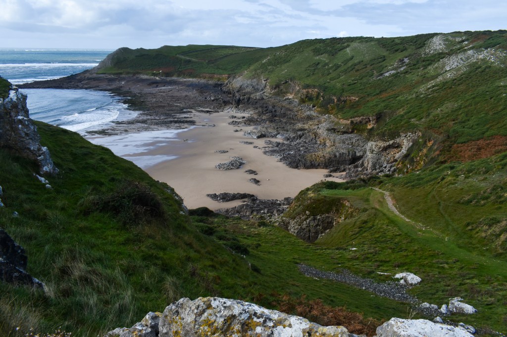
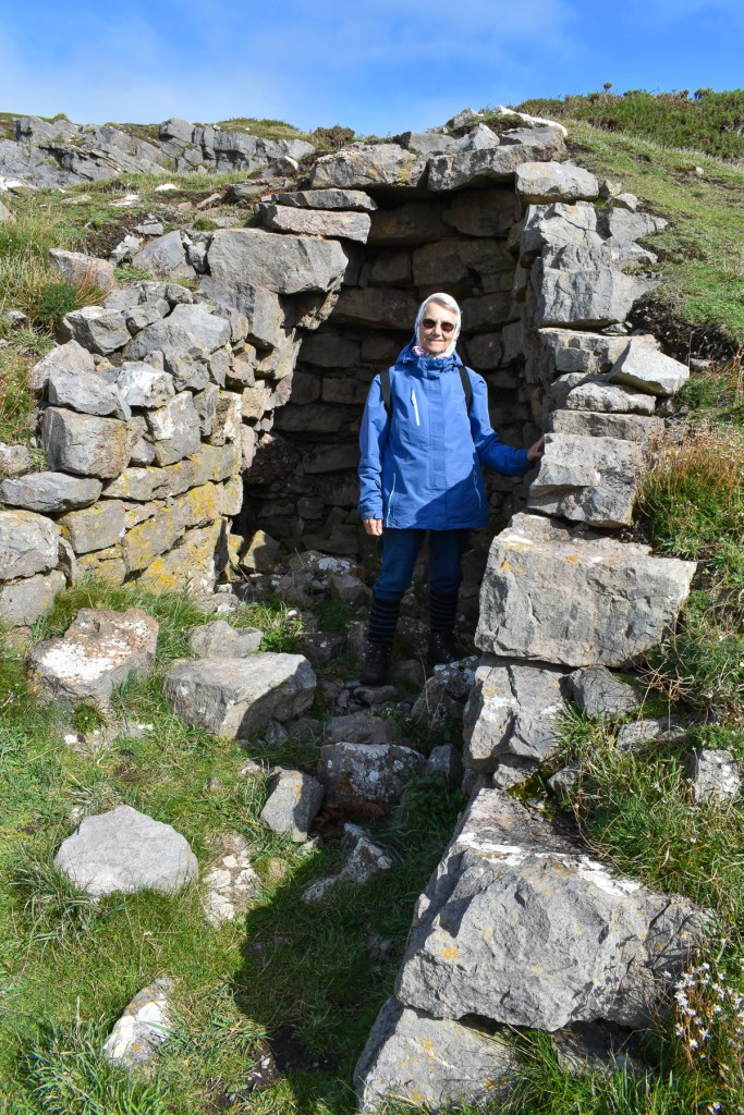
We moved on, now going direct east toward Mewslade Bay. What we didn’t appreciate at the time was we’d veered away from the main coast path. But the scenery was so captivating that was of no consequence. We came across a narrow strip of rugged rock pointing out to sea. Looked the sort of place I might’ve dared investigate more closely when a foolhardy youth, but the maturity of arthritis warned me off such an adventure and I was happy to make do with photographs. A pair of odd oval stone shelters appeared and we had a closer look. No idea who’d built these, or why. But they’d give some small relief from the wind, though not much from any rain.


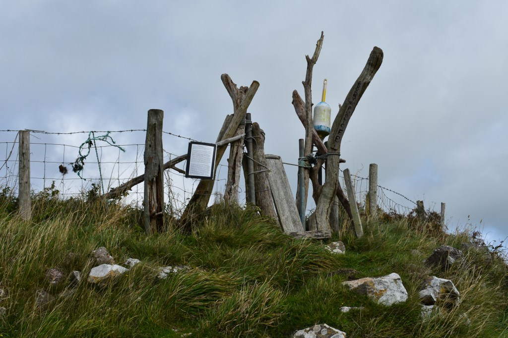
The path then veered away from the coast and took us a bit further inland, where we came upon a makeshift barrier with a notice displayed by the National Trust, explaining that they were attempting different plants in the hope of attracting some birds to the area. It was out of bounds for the time being because of this.


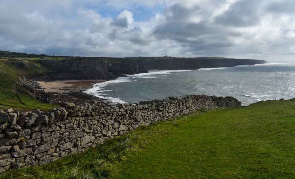
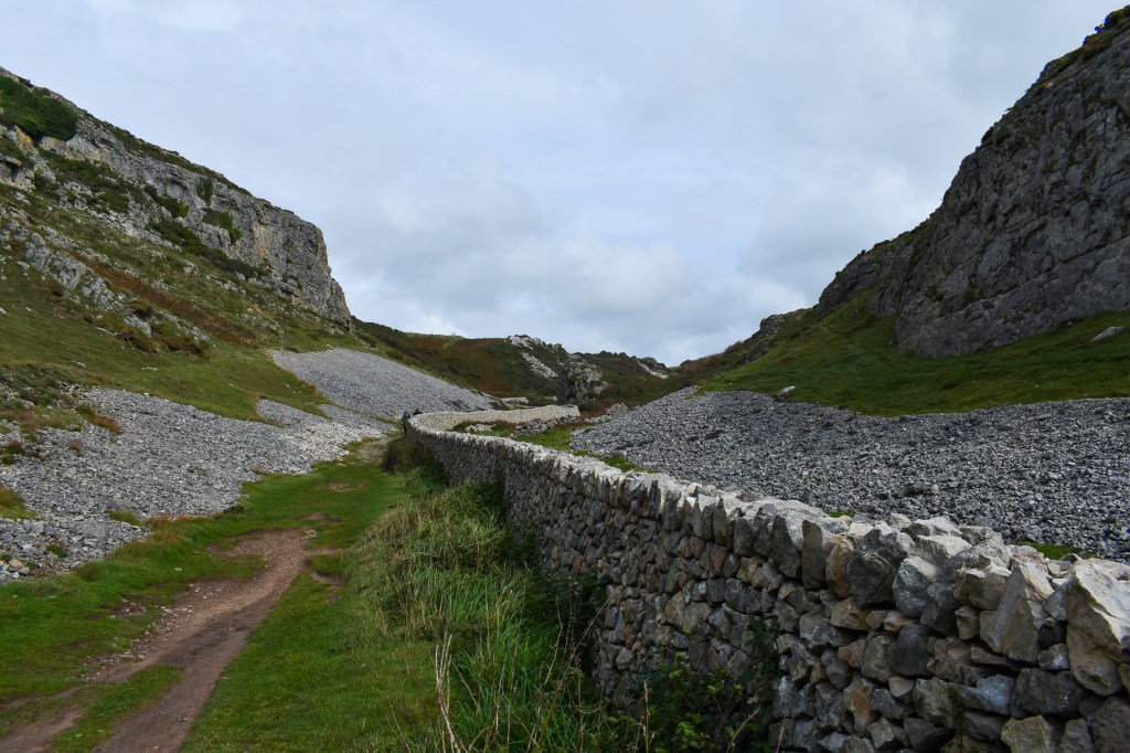
We continued on the smaller path we were following and came to a drop toward Mewslade Bay. There, we found a rather well-made drystone wall with the path running beside it. A father and his young daughter were collecting blackberries from the wild bramble briars and we asked him where the path led.

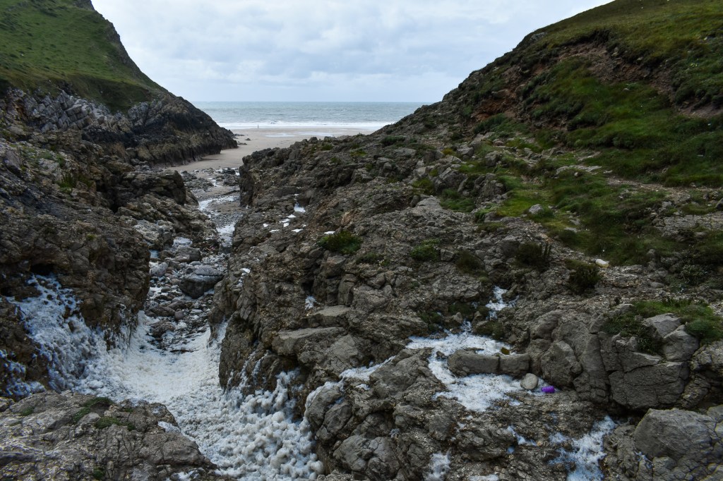
In one direction, it took us to a very narrow rocky inlet on the bay. This was full of foam from the breaking surf on the rocks. The sea tide was now out, but access via this route was unwise and unattractive, so we returned along the path. We passed a rocky outcrop with some weather sculpted holes that had been partially blocked with iron bars to prevent the curious from entering them. It wasn’t hard to imagine the rescue organisation extracting some unwary potholer from these narrow spaces before the barriers had been put in place.

Further along, we came to a pleasant track through trees leading to a farmyard and then a car park on the edge of the village of Pitton. We joined the road here for a short way until we reached Middleton, where we were able to cross the fields and make our way back toward the edge of Rhossili.


We stopped for lunch at a small cosy café called the Lookout, where we had a tasty lunch and hot drinks. This was a pleasant spot and we decided we’d return during the week.

Back to the hotel, where we remained because the rain decided to set in at that point. But we’d had the best of the day and enjoyed our walk. I took only 225 pics on this one, so selection wasn’t quite so difficult!
Day 5 will follow shortly.


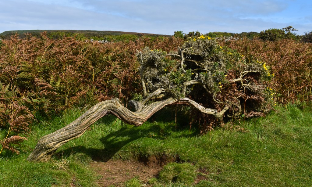
Terrific photo essay. My favorite image is the sculpted tree.
LikeLiked by 1 person
Thank you. I was rather taken with it, too.
LikeLike
Thanks, Miriam. There are a couple more posts to come from this trip. It’s certainly an area we will return to; very beautiful. So glad you’ve enjoyed the vicarious visit.
LikeLiked by 1 person
Terrific photos. 🙂
LikeLiked by 1 person
Thanks, Lynette. I spent the first part of my working life as a professional photographer, but then started writing fiction. I enjoy making pictures again, now I have a little more leisure time.
LikeLiked by 1 person
Your talent as a professional really shows. 🙂
LikeLiked by 1 person
Thank you, Lynette. It’s something I love doing and sharing.
LikeLiked by 1 person
I have greatly enjoyed following your walk along the coast via your excellent photos. It is pretty stunning and I can just imagine how that nature would draw you in.
Miriam
LikeLiked by 1 person