

This is the third post in this series, and continues the account of the walk from Charmouth to Golden Cap. For Part 1 of this account click here. (You’ll find the start of the series of five posts here.) And Part 1 of the walk to Golden Cap is here.

Walking up the cliff paths to this high spot on the south coast of England, we occasionally came across signs of an imminent landslip that will, in the not-too-distant future, take a portion of the cliff down toward the sea.
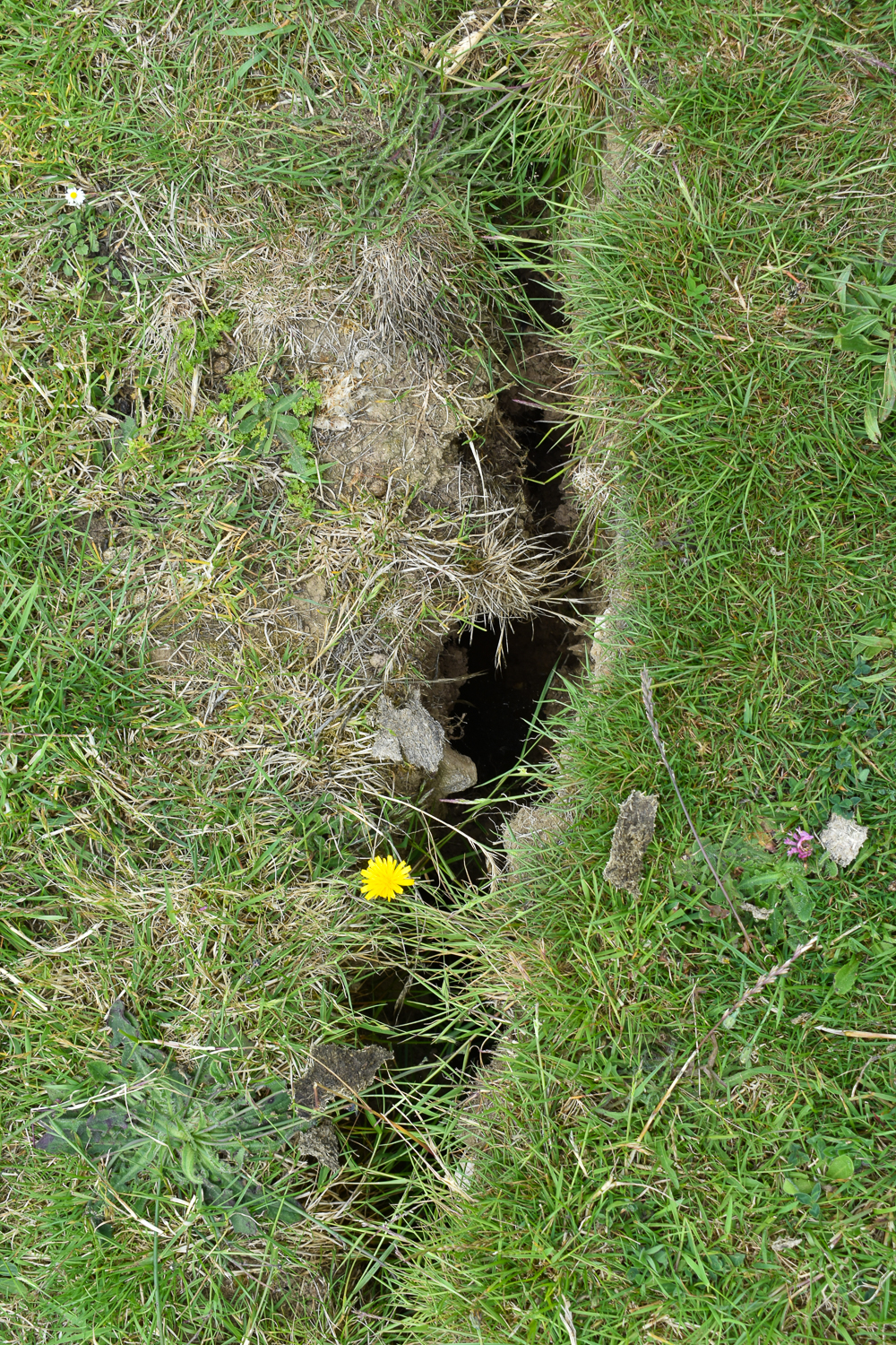
Large cracks show how unstable the land here can be. We kept on the landward side of such divides!
Approaching the peak, the way is constructed from wooden steps holding the underlying mud in place in an attempt to prevent erosion ruining the experience.
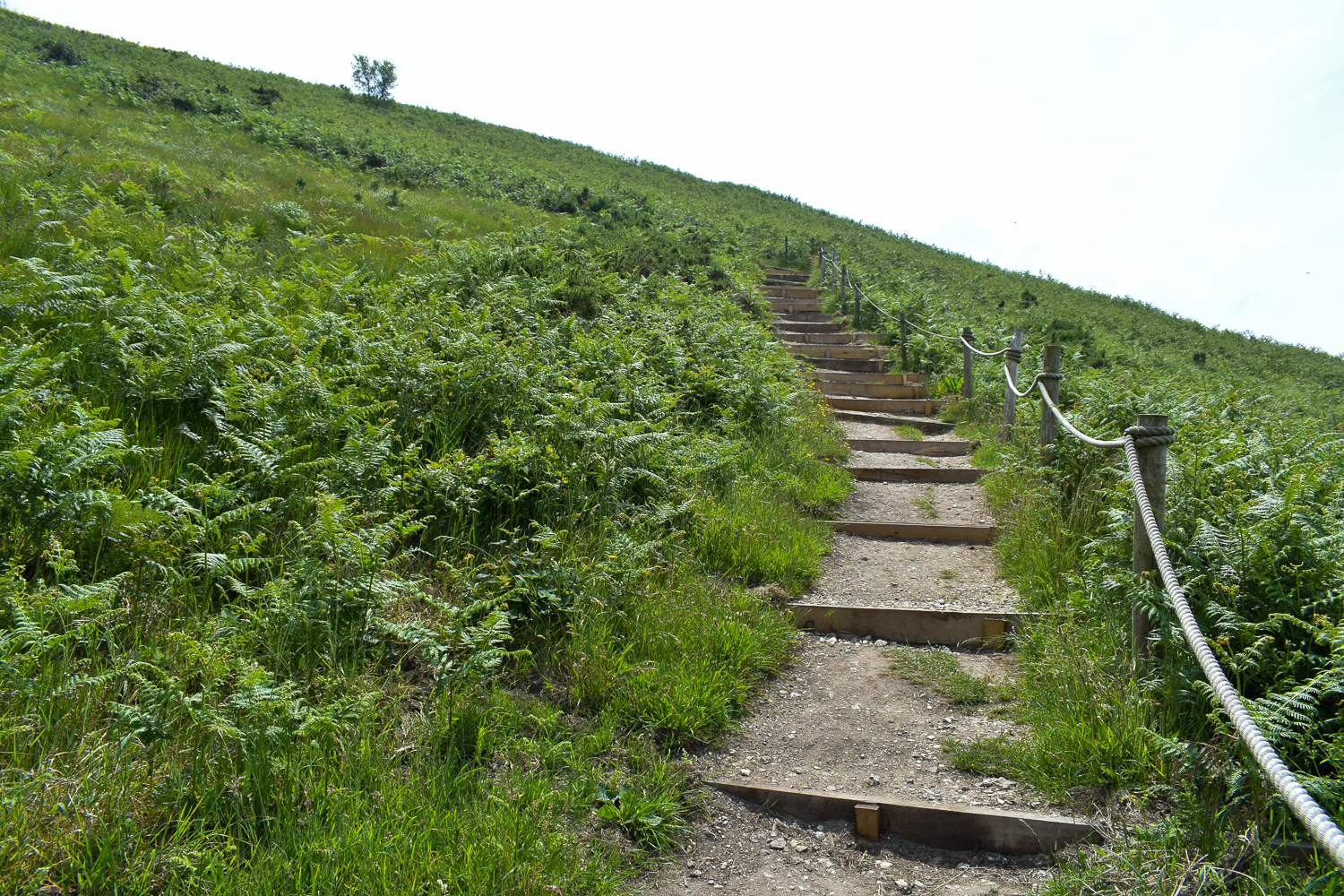
There are even a few benches sited to give walkers a much-appreciated rest.

At the top of this final stretch the path emerges onto a low mound of open ground. A large group of people were assembled here and it was clear many assumed they’d reached the top.


I’d walked this route some forty years or so previously – on that occasion I’d come across a guy sitting on a log at the top using a screwdriver to fix his wooden leg! As a result of that earlier visit, I know there’s a trig point (a device used by the Ordnance Survey teams when making maps) marking the highest part of the peak.

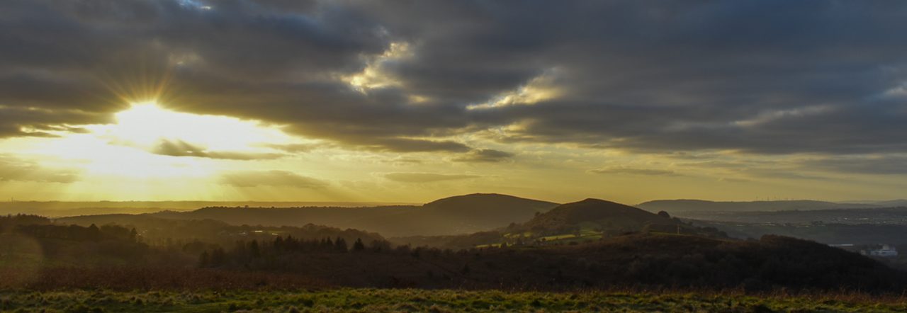
It’s approached along a relatively level path, which we took until we arrived at the concrete pillar marking the spot. We were alone for a while here, and the sun shone brilliantly from a sky that was clear above, even though there remained some light mist over the distant Charmouth and Lyme Regis.
We took our ‘trophy’ photos, just to show we’d made it. Then we started our return, stopping at a bench along the seaward side of the path leading to the trig point where another couple were enjoying a rest. They shuffled up to allow us to sit. As we relaxed, the large group from the small mound passed by on their way to the summit.

On our way up, we’d passed a finger post pointing to the ruins of an old church. We decided to take a different route back and moved down to have a look at the ruins.
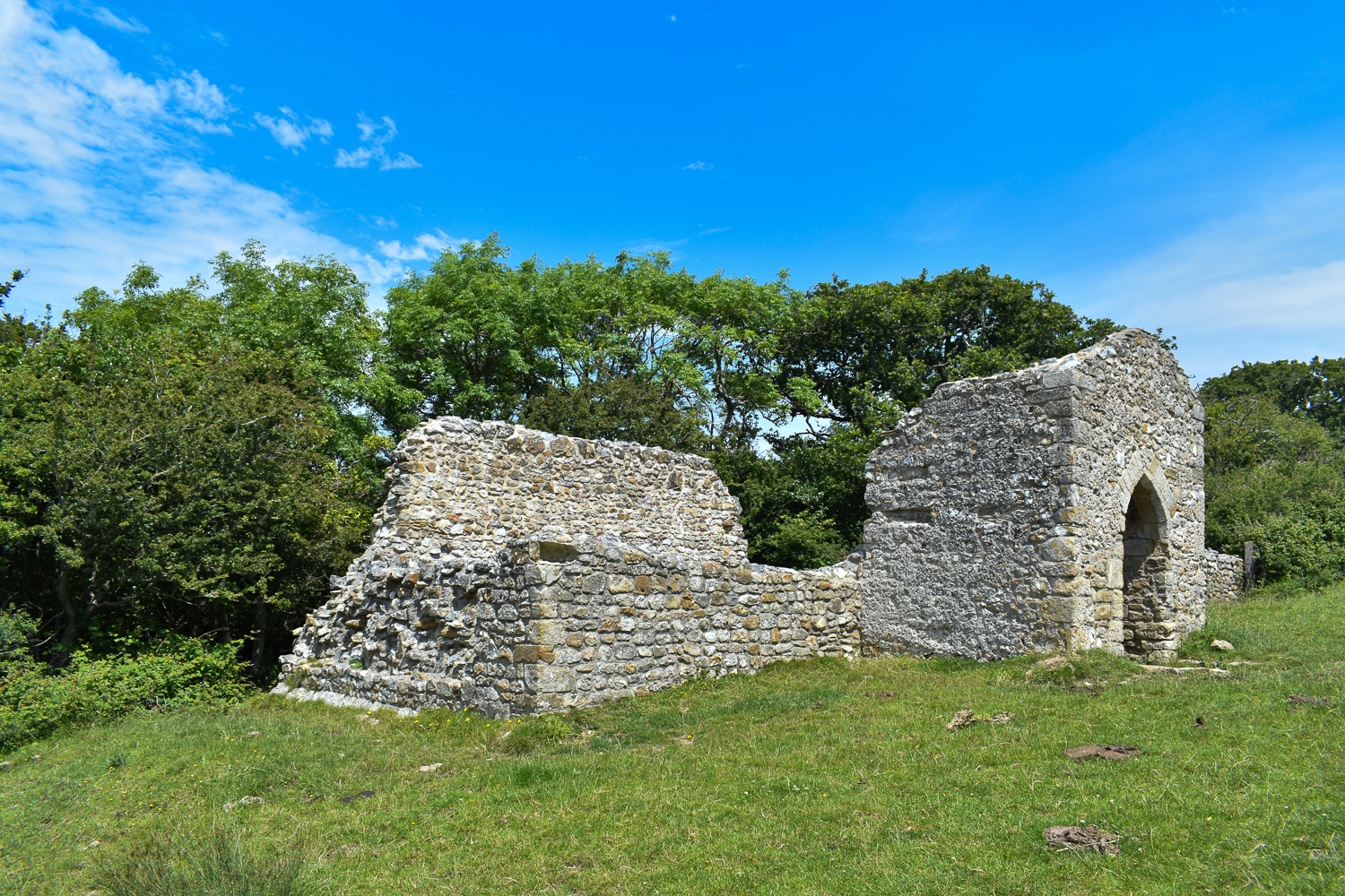
The old church was obviously a small place, and not much of it is left. It was once St. Gabriel’s Church, apparently named for the mythical archangel, which served the now vanished hamlet of Stanton St Gabriel, where the folk made a living from agriculture and fishing.

Close by is a National Trust property, St Gabriel’s House, which is an 18th century manor house now divided into 4 holiday cottages. They form a pretty isolated spot for a holiday, reachable only via a drive along a very narrow stony lane a little over half a mile long and beginning at the minor road known as Muddyford Lane, which leads off the main road, the A35.

From here, our route took us to the tiny farming community of Upcot and then across Chardown Hill.


This path leads to a car park that stands at the termination of a wide stony lane running along the ridge of Stonebarrow Hill, at the other end of which are seasonal toilets and a small shop run by the National Trust.
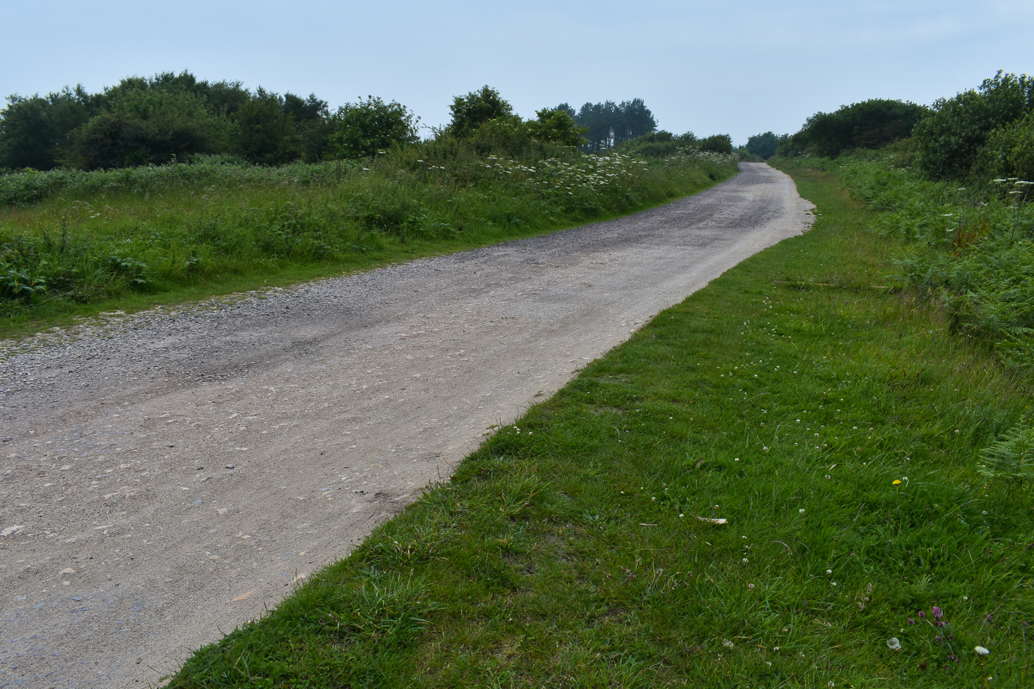
The walk from this point is along a very narrow, twisting, and steeply falling road that occasionally gives lovely views over the surrounding countryside. It’s easy walking, though the hardness is unkind to feet and knees wearied from the earlier walk.

The traffic, on this warm, summer Monday was very light, but the size of the car park suggests it may become very busy on summer weekends and perhaps during school holidays.

Eventually, we found ourselves on the outskirts of the small seaside town of Charmouth, at a fair distance from where we’d left the car. A public footpath dodges between some houses and leads down toward the sea. We were glad to be back at the car, where we changed our walking shoes for the town shoes we’d left in the boot.

A short amble across the shingle took us to the Beach Café with its outside tables well occupied but some free space inside.
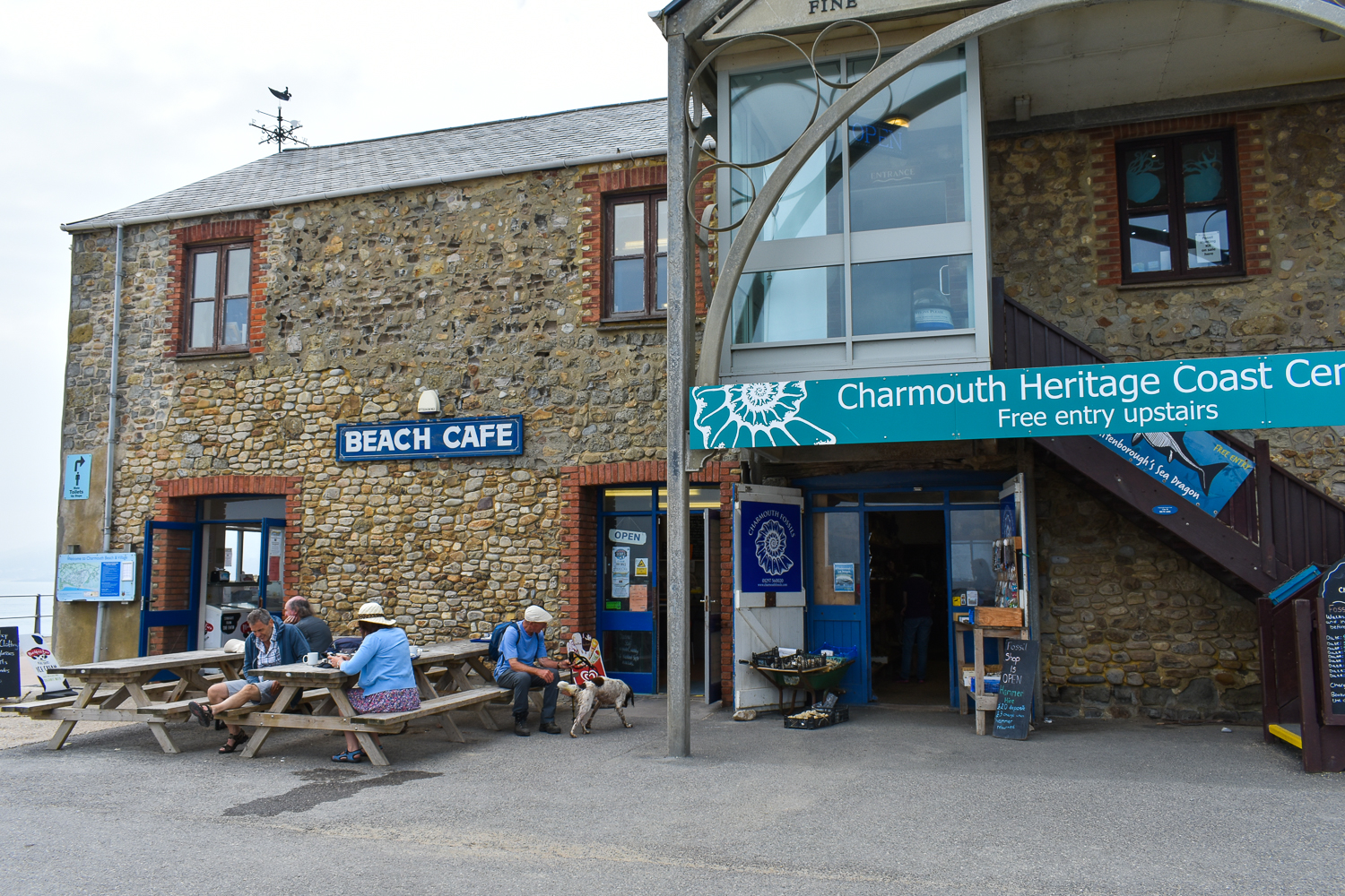
We’d been out for a few hours with only the water we were carrying, so some refreshment was needed. As I approached the counter, at around 15:00, Valerie pointed out the sign hanging above the large menu running across the top of the room. It said they’d stopped cooking at 14:30! So, no bacon butty for me. No matter, I ordered a coffee and some tea and two slices of what was labelled ‘Victoria Sponge’; a cake as yet uncut. The slices were generous. Unfortunately, the sponge was pretty solid and the filling consisted of a butter cream made, apparently, with granulated sugar judging by its grainy and oversweet quality. The jam was similarly grainy and very sweet. Not what we’d hoped for. But the food filled a space and replaced our spent energy and the drinks quenched our thirst.
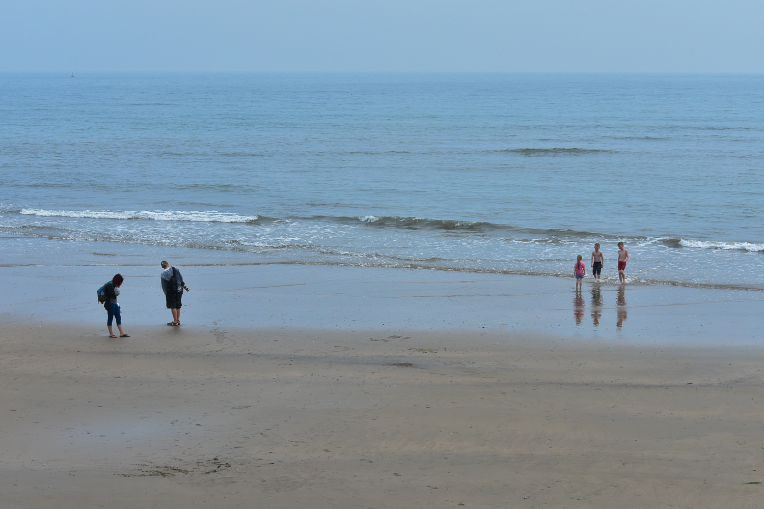
I estimate our circular walk had measured around 7 miles. We returned to our holiday home for a quiet sit and some relaxation. Our intended evening walk into town was ended by rain, so we made sandwiches instead.

The next part of this account will follow soon.


So green. So beautiful. Keep sharing.
LikeLiked by 1 person
Thanks, Bojana. I’ll keep posting these for as long as they entertain and inform.
LikeLiked by 1 person
An interesting part of England. Sounds like a good walk but not one we could make. The beach cafe looks cute but cake that is too sweet makes me ill.
LikeLiked by 1 person
A shame you won’t be able to experience this in person, Darlene. Hopefully, my posts will bring some of the flavour to you. The Beach Cafe is very popular, so they obviously do some things right there. In fact, as I was waiting, a woman behind me in the queue was complaining about the end of cooking and saying she and her family go there regularly because the food is so good!
LikeLiked by 1 person
I’m sure we could visit the area, just couldn’t do the walk up to the top. One can’t judge a place just by one too sweet slice of cake, can we!
LikeLiked by 1 person
The nearest you can aproach Golden Cap in a vehicle is the National Trust properties at Stanton St Gabriel. But access is along a fairly rough track, so you need a tough car. Even from there, although the distance is reduced to a little over half a mile, you’d still have a climb of around 400 feet.
Agreed: a slice of cake isn’t a guide to the full menu anywhere.
LikeLiked by 1 person