

On our third day at Rhossili (click here for day 1, here for day 2) we celebrated our wedding anniversary (31 years), so, naturally, we decided to climb Rhossili Beacon, where a force 8 gale was blowing! I took only 273 pictures this time, so selection was a little easier.
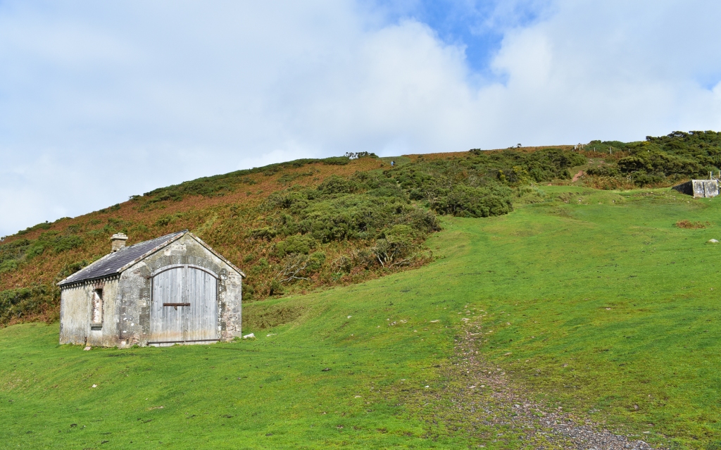
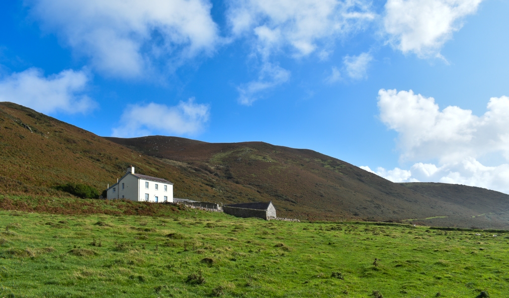
After a relaxed breakfast, overlooking the bay, we dressed for our challenge and set off. The road took us as far as the entrance to the hill, passing some houses and a small barn before the slope opened up. Already, the strength of the wind was evident and we stopped for a moment to decide whether it was wise to carry on. As the wind was off the sea, we decided the worst was that we’d be blown off our feet onto the heather, so continued.
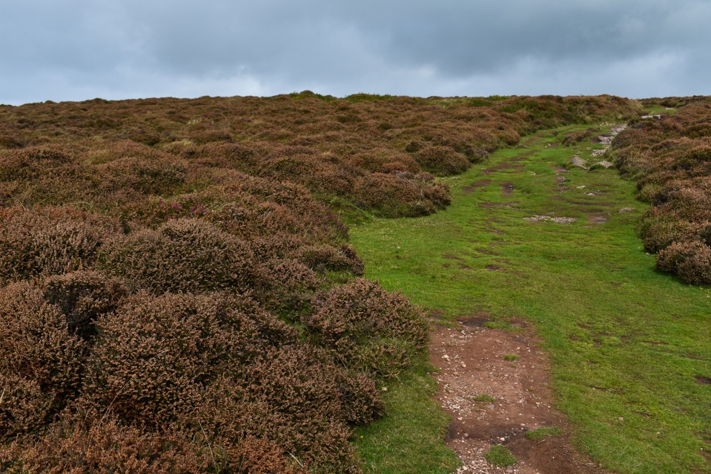
It’s a fairly steep walk to the ridge on the top and shows signs of a multitude of booted feet over the years. We did our best to avoid adding to the erosion.
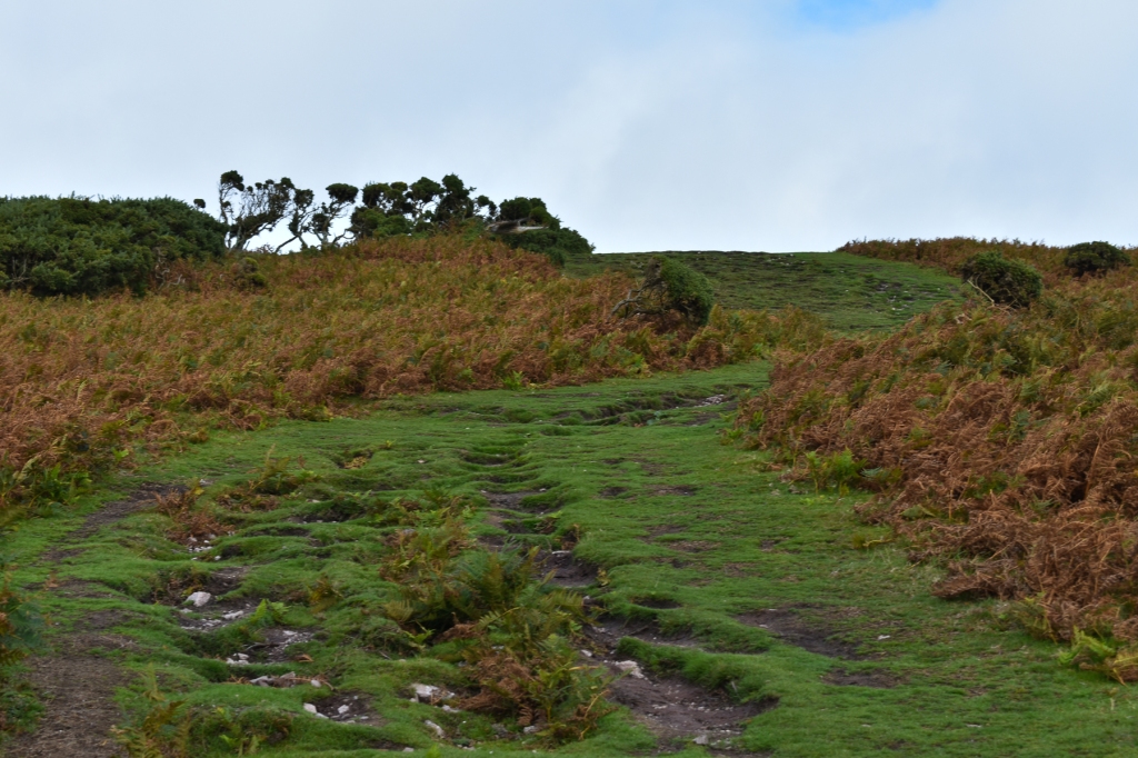
It’s easy to get lost in the climb when ascending but we usually walk to enjoy our surroundings, so we stopped frequently to look back. The landscape changes almost with every step up, so such pauses are generally rewarding.
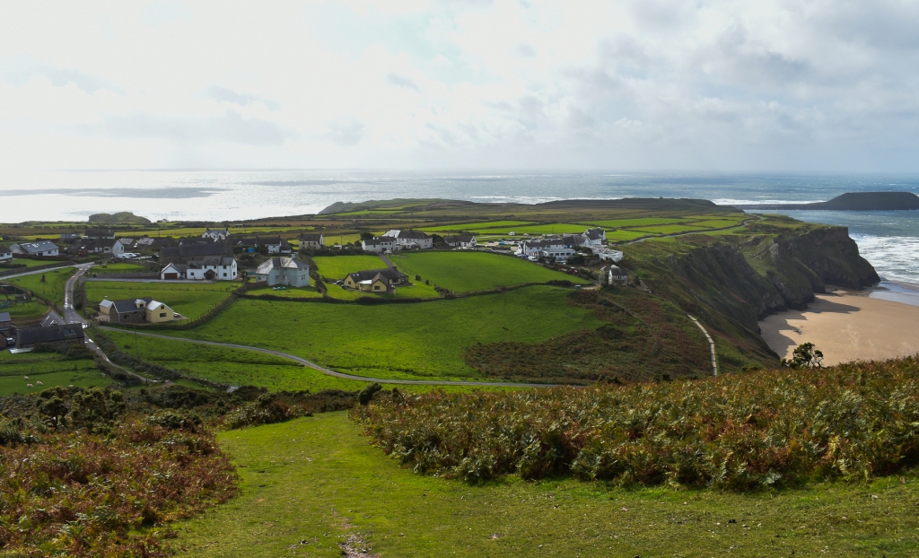

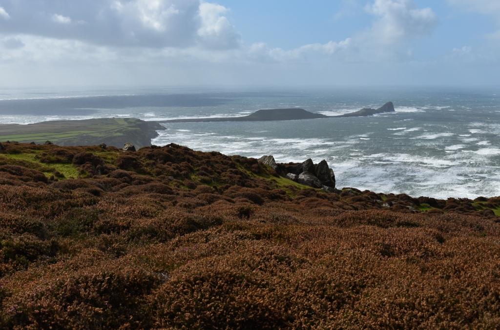
As we reached the ‘top’ and started the walk along the ridge, so the bay and the beach below came into view, and we had views forward, west and back. For this portion of the walk, the east is mostly heather and bracken-clad moorland, as the gradient of the hill hides the further landscape from view.

Ordnance Survey have installed one of their trig points on the highest point of the hill. It stands at 633 feet (193m) above sea level on a slight mound above the general level of the ridge. For some peculiar reason, the rushing wind felt the need to intensify as we approached the concrete pillar. But, leaning into the airflow, we made it. Mind you, I had to cling to the trig point to take a picture, otherwise I’d have been blown into the heather across the path some forty or so paces away!

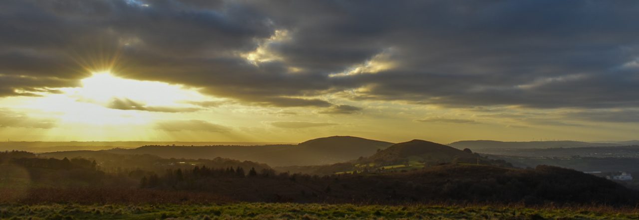
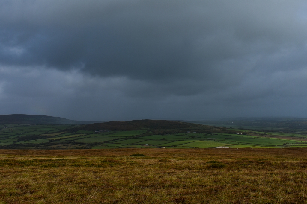
The views from this high point made the effort worthwhile. But looking to the north we noticed dark clouds and hoped those winds would blow the wet weather away to the east rather than toward us. As it was, we trekked through fitful sunshine with white clouds scudding overhead; very stimulating and so typical of our British climate.
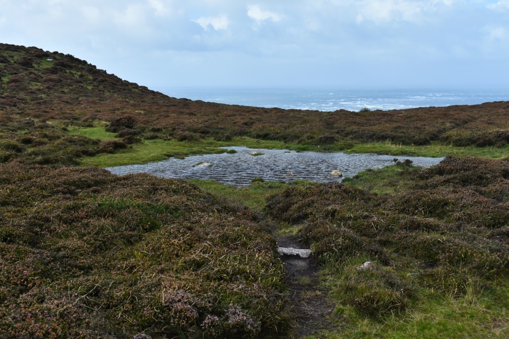
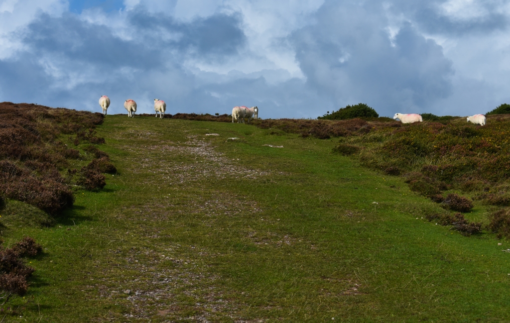
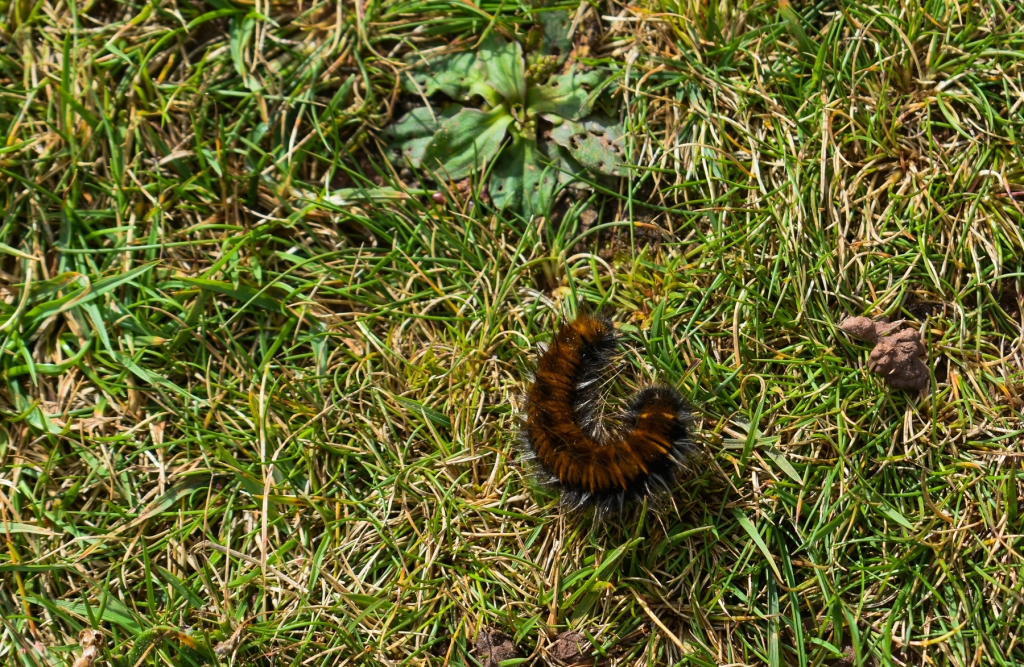
Further along, we came on some sheep that gazed at us with expressions suggesting they considered these two bipeds harmless lunatics and continued to munch on the grass as we passed. A small puddle displayed a fine illustration of a ‘storm in a teacup’, and a tiny hairy caterpillar braved the gale as it huddled in the smart grass.
As we took a bend and descended to a shallow saddle in the hill, we encountered evidence of human engineering. Large blocks and foundations of concrete marred the rural landscape. A question or two at the hotel later told us this was an abandoned WWII radar station.


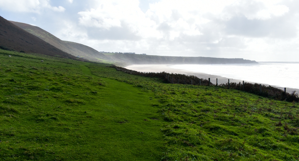
Once past this sign of an old conflict, we had our first sight of our destination, the static caravan site known as Hillend. But it disappeared for the time it took to fight our way up to the next high point, the cairn above Bessie’s Meadow, that stands 607 feet (185m) above sea level. And from here we could see Hardings Down to the east and the village of Llangennith huddled at the foot of Llanmadoc Hill (611 ft, 186m) to the northeast.


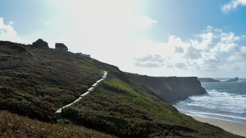
The earlier threatened rain had been blown away and our sunshine continued to peek out from fast-moving clouds above as we caught site of the small island of Burry Holms at the northern end of the bay. Hillend became more visible as we descended a slope so steep it had earned a warning sign.


Once at the bottom of the hill, we turned back south, leaving the caravan site mostly hidden by high hedges as we followed a winding track that was in places wide, in others narrow and running with a small stream of surface water.
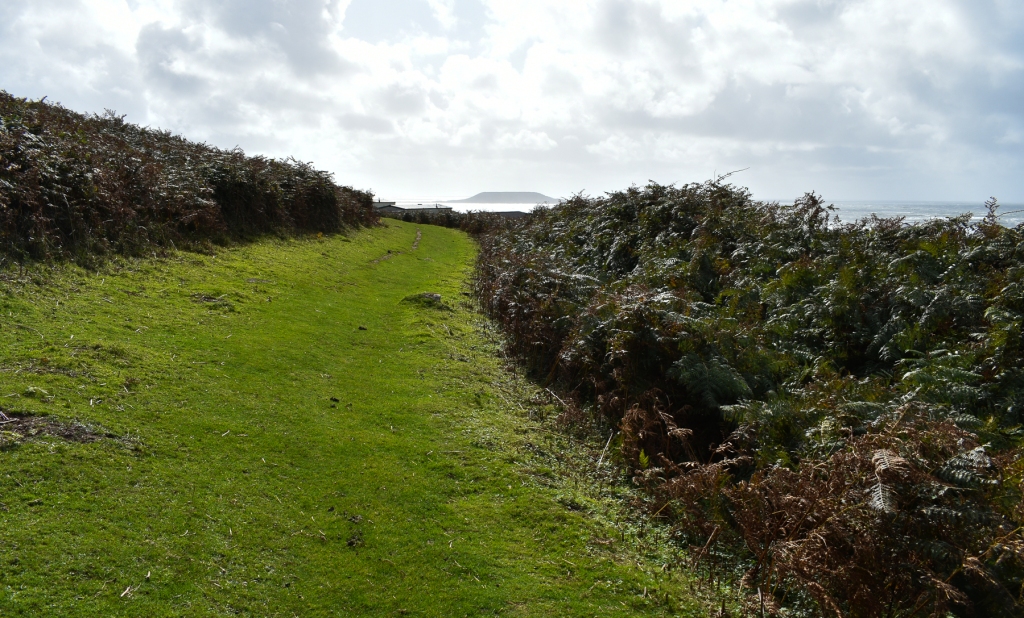

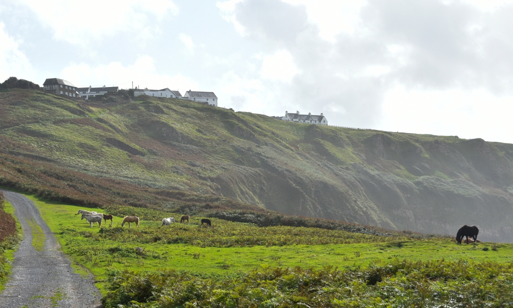
That eventually opened into the narrow fields at the foot of the Beacon, with the hill to the east and the sea and beach to the west. We walked past the Old Rectory, and encountered the ponies grazing on the lush grass. Slowly, the views both north and south opened up as we were able to walk closer to the low cliff that separates the hill from the beach.


Finally, we passed the steps leading up into the village and continued along the track until we reached the point where our walk had started. We decided to risk the Causeway for lunch, of which the less said, the better.

Back in the hotel, we relaxed, pleasantly wearied by our walk, until it was time for dinner to celebrate our anniversary. During a break in the eating, while we finished our prosecco before dessert, we met and chatted with a delightful couple who had been drinking on the terrace outside. James was from Zimbabwe and with his partner Lola, from London, and we had a pleasant chat before our sweets arrived. A little time later, this couple of newly met strangers returned bearing two of those single-glass bottles of prosecco and handed them to us with good wishes for our happiness. Such kindness brought a lovely glow to the end of our special day and we returned to our room, after a short walk in the moonlight, feeling the world was a better place.

Day 4 will follow shortly.


Oh my, these are just stunning.
LikeLiked by 2 people
Thank you, Bojana. It’s great to know people are enjoying my photos.
LikeLiked by 1 person
Keep taking them and writing, Stuart, and thanks for sharing.
LikeLiked by 1 person
Will do, Bojana.
LikeLiked by 1 person
Another lovely trip full of interesting info. I’ve never been to the Gower; obviously we need to rectify that. Thanks for sharing.
LikeLiked by 1 person
We’d not visited before, but we’re only 8 miles from the border with Wales here, so we’re exploring this lovely part of the country a bit more now. Definitely worth a visit, Linda.
LikeLike
Beautiful photos – especially of the beach.
Happy Anniversary! 🙂
LikeLiked by 2 people
Thank you, Lynette. There will be more of the beach in another post, as we spent one of our days walking there. Again, it was windy, but some great image opportunities. Enjoy!
LikeLiked by 1 person
Your photos are stunning! Thanks for sharing your trip. Someday I hope to travel to the UK, but in the meantime, I’ve enjoyed armchair traveling with you.
LikeLiked by 2 people
Thank you, Janet. It’s part of my reason for posting these, so people who can’t visit can at least get a flavour of the places. There’s a real possibility that in the not too distant future travel overseas may become a lot more difficult for most people, as the problems of the climate emergency begin to bite progressively harder.
LikeLiked by 1 person